
Back to the Future
If my calculations are correct, when this baby hits 88 miles per hour,
you’re gonna see some serious shit.
It works! It works!
I finally invent something that works!
I come back to the future!
Great Scott!

If my calculations are correct, when this baby hits 88 miles per hour,
you’re gonna see some serious shit.
It works! It works!
I finally invent something that works!
I come back to the future!
Great Scott!
I’ve seen the Back to the Future series lots of times on TV and in the cinema.
For my generation, the 80s and 90s, it was a really big deal in the cinematic world.
I always liked the idea of getting on the DeLoren, picking a date in the past or future and seeing things for myself.
But is time travel possible?
We can say yes to that, and I’ll tell you how.
The DeLoren in question is the plane, and the energy is the time zones.
People often hear about jet lag from travelling between continents.
This temporary sleep disturbance can occur when you’re travelling really quickly across different time zones.
The body doesn’t have time to adapt to the time change, and ‘the biological clock’ doesn’t synchronise with the local time of the destination.
I’ve never had any problems with jet lag, probably because I don’t sleep much or maybe because I have too much sleep left over.
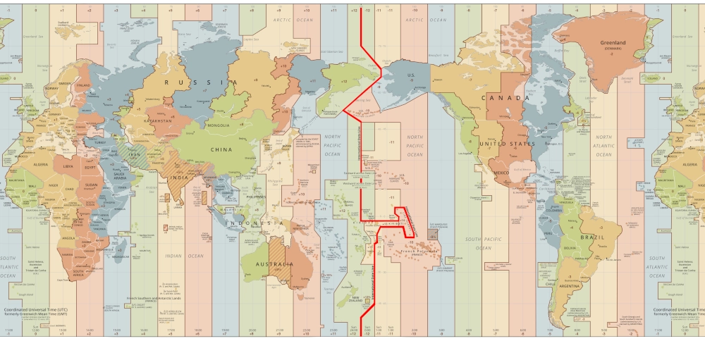
time zones from date change line
Even before I knew I’d become a traveller, I was always interested in geography.
My way of travelling is also a mix of history, politics and, of course, geography.
I always checked which cities were at a similar latitude to Cagliari (they’re Beijing, Madrid, Athens, Istanbul and Cosenza) and longitude (Stuttgart).
Geographical coordinates are all about time zones too.
But what are time zones?
Time zones are a time division system used to organise the hours of the day according to geographical location.
They basically make sure that the day is adapted to the Earth’s rotational movement, which means that time everywhere reflects the natural cycle of day and night.
The day is 24 hours long, so you can just draw 24 straight lines of longitude, every 15 degrees, to mark the centre of each time zone, with one hour difference from the previous and next zone.
But these lines only work in theory. Each country can choose its own time, and doesn’t have to respect the time zone it actually falls in.
That’s why, when you look at the time zone map, the lines are all over the place and really complicated.
For practical and political reasons, 39 time zones are used today, identified using Coordinated Universal Time (UTC) as a reference.
Plus, some states use daylight saving time, moving the time forward one hour during the summer months.
The first time this happened was on 30 April 1916, during the First World War.
Kaiser Wilhelm II of Germany introduced the time change to save fuel and imposed it on his allies and occupied territories.
Different countries used different meridians as reference points for their nautical and astronomical charts.
Before we had time zones, each city used its own local time based on the sun.
For example, midday was when the sun reached its highest point.
All this was fine until the advancement of technology and the increase in long-distance relationships made the concept of time and schedule problematic.
When the first long-distance railways were built, the time difference became a major problem, especially on connections between distant cities on the east-west axis.
In the mid-19th century, railway companies around the world began lobbying their respective governments to unify their national timetables.

Tren del fin del mundo – 2016 Patagonia travel
The first railway to solve this problem was the London to Bristol line, which adopted Greenwich time in 1840.
Then, in December 1847, the British railways got their timetables in sync for the first time, and introduced ‘railway time’.
From 23 August 1852, this time was sent by telegraph to the Royal Observatory in Greenwich.
From 1855, it was called ‘ora media di Greenwich’ (GMT) and in 1880 it became official UK time.
The United States adopted the same system a few years later, but with four time zones (Eastern, Central, Mountain and Pacific Time), which were between five and eight hours behind Greenwich Mean Time.
The Italian multi-disciplinary genius Quirico Filopanti (pseudonym of Giuseppe Barilli) published the scientific philosophical religious work ‘Miranda’ in 1858, in which he proposed for the first time to divide the globe into 24 time zones and to establish a universal time for astronomy and telegraphs.
In the newly-born Kingdom of Italy, from 12 December 1866, the ‘mean time of Rome’ was adopted for railways, post and telegraphs, with the exception of Sardinia (which maintained the Cagliari mean time, used in the Kingdom of Sardinia) and Sicily (mean time of Palermo).
In Sardinia, Rome time was adopted only from 1886, except in a village near Alghero. This village chose to synchronise with Rome from 1872, because they felt inferior to the capital Cagliari..
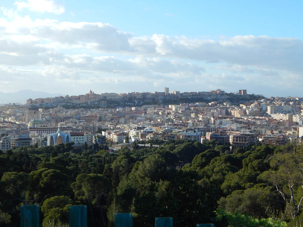
Sardinia – Cagliari from Viale Europa
On 1884, the International Meridian Conference got 26 nations together in Washington to set international standards to solve these problems.
Here it was decided that the Royal Observatory at Greenwich would be used as the Zero Meridian of the world and it was given degree 0 of longitude.
This was the starting point for the geographical coordinate system and the standard used to measure east-west distance on the earth’s surface.
Picking Greenwich as the reference meridian made it easier to standardise the measurement of longitude and time all over the world.
But it wasn’t all smooth sailing: there were some pretty heated debates between the French and British over who should get the zero meridian. France stuck with the Paris Meridian until 1911, when they finally adopted the International Greenwich Meridian.
Spain was one of the 26 participants in the Washington meeting, and it is in the Greenwich time zone, but it didn’t switch to that time zone until 1 January 1901.
Up until then, Spain’s official time was based on the Madrid meridian, but each province had its own time based on its own meridian (the difference between La Coruña and Barcelona was about 45 minutes).
The Royal Greenwich Observatory is a really important place in history and culture, and it’s still a big deal for astronomical studies and tourism.
Millions of people visit the Greenwich meridian line every year to see the point where the Earth is divided into two hemispheres: the western and eastern.
Greenwich Meridian in the Basque Country – 2009 Travel
Another key decision made at the 1884 International Meridian Conference was about international time.
GMT (Greenwich Mean Time, Ora Media di Greenwich), the zero meridian time zone that would be used as the reference time for all time zones, was chosen as the international standard.
Then in the 1950s, atomic clocks were invented, which were much more accurate than those based on solar time.
So, GMT was basically rendered obsolete, although we still use the name for political reasons.
Since 1967, Coordinated Universal Time (UTC) has been used around the world to keep time in sync.
This standard doesn’t take daylight saving time into account, which can vary from country to country, but on an atomic time scale.
Obviously, there’s been a lot of debate about this.
The International Telecommunication Union (ITU) wanted to pick one abbreviation for the acronym to be used for Coordinated Universal Time, but as there was no agreement between the English (CUT, Coordinated Universal Time) and French (TUC, Temps Universel Coordonné) acronyms, the compromise was to use UTC.
Times go up east to Greenwich (UTC+1, UTC+2, etc.) and down west (UTC-1, UTC-2, etc.).
The date change line was also set at the same meeting.
If you look at a world map, you’ll see a twisted line in the Pacific Ocean that divides the world into two parts.
That’s the date change line, an imaginary line located at about 180° longitude, which crosses the Pacific Ocean.
Picture this: two people leave from the same spot at the same time, going in opposite directions at the same speed.
After a while, they’ll end up on the ‘other side of the world’.
That point could be the Date Line, about 12 hours off the Greenwich Meridian.
If you travel east, you’ll end up 12 hours ahead of GMT, and if you travel west, you’ll be 12 hours behind.
The Date Change Line is what decides the date changes during east-west travel.
It’s really important for keeping time and the calendar in sync, so we don’t end up with days ‘overlapping’ or getting confused about dates.
Despite its name, the Date Line is not geometrically a straight line.
In some areas, like near the Pacific islands, it’s drawn so as not to divide countries or territories, to keep dates consistent.
If it wasn’t, it would be a total nightmare for those countries to manage the days.
There’s no official document or treaty that sets out the exact route of the date change line.
Just as each country can choose its own time zone, even more countries close to the 180th meridian can unilaterally change the path of the date change line.
If I’ve explained this well, you’ll see that time travels are possible.
If you travel the few miles between two countries on the Date Line, you’ll end up with a time difference of almost 24 hours.
If you travel from west to east, you’ll go back 24 hours.
If you travel the other way, you’ll go forward 24 hours.
So, you can basically travel through time.
This means that by flying at night it’s possible to experience the same day twice or not at all.
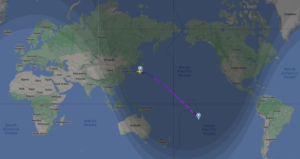
That’s exactly what happened to me when I travelled between Auckland (New Zealand, west of the Date Line) and Rarotonga (Cook Islands, east).
2019 Oceania travel
Let’s have a look at which countries are close to the Date Change Line and allow time travel across it.
As we said, the Date Change Line is an imaginary line that runs roughly along the 180th meridian, and it’s used to decide on time zones and day changes.
But it’s not a straight line because it has to take into account what each country needs.
Some countries and territories are geographically west of the 180° longitude line but east of the date change line, and vice versa.
Because of all these changes and deviations of the line in certain areas, there are particular time zones.
That’s why, instead of splitting up countries based on whether they’re east or west of the date change line, I think it’s better to group them by their time zone:
These are the countries that are ahead of Greenwich Mean Time are:
Russia (Kuril Islands)
Vanuatu
Solomon Islands
Australia (some regions)
New Caledonia
Micronesia
Papua New Guinea
Fiji Islands
Kiribati (some islands, including the capital Tarawa)
Marshall Islands
Tuvalu
Nauru
New Zealand
Russia (Kamchatka)
Wallis and Futuna
Samoa
Tonga
Kiribati (some islands)
Tokelau (that’s where my website gets its .tk domain from)
Kiribati (some islands including Kiritimati and the Equatorial Sporades, also known as the Line Islands)
These are the countries that are behind Greenwich Mean Time:
Cook Islands
French Polynesia (some islands such as Tahiti, Tubuai and Tuamotu)
Hawaii
Alaska
Niue
American Samoa
No nation uses this time zone, but there are uninhabited US territories within it that are mainly used for military purposes.
The North Pole uses Greenwich Mean Time,
The South Pole is 12 hours ahead of the North Pole,

Svalbard Islands – Magdalenfjorden – 2018 Arctic Expedition
The Trans-Siberian Railways, which travels 9,288 km from Moscow to Vladivostok, crosses 8 Russian time zones, but at all stations, on tickets and on the tables on board the train, only Moscow time is shown.
This time zone is used for all railways in Russia.

2011 Trans Siberian travel – timetable
The People’s Republic of China is the third largest country in the world.
Its territory spans five time zones, but there’s one time zone that covers the whole country: Beijing time, which is UTC +8.
This means that in the westernmost part, the times are quite unusual: in December, the sun rises at 10.15 a.m. and sets at 7.45 p.m., in summer sunrise is at 7.30 a.m. and sunset at 10.30 p.m.
Midday in Beijing – 2011 China Travel
The Gilbert and Ellice Islands were a British Pacific colony from 12 January 1916.
In 1975, the Ellice Islands were legally separated from the Gilbert Islands.
Then in 1978, the Ellice Islands became independent and took on the new name Tuvalu.
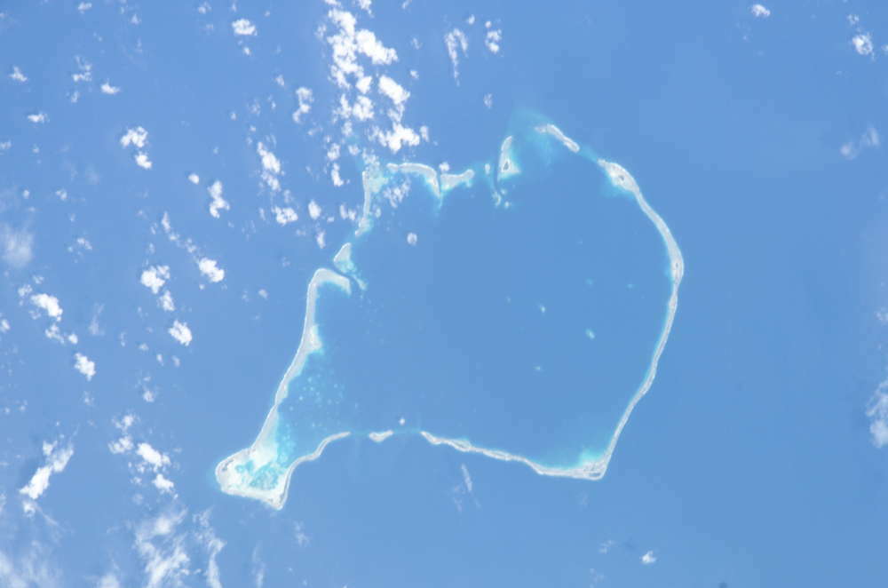
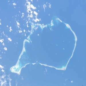
Funafuti (Tuvalu) from the plane – 2019 Oceania travel
The Gilbert Islands became independent on 12 July 1979 under the name Kiribati.
The islands of Kiribati are spread over millions of square kilometres.
Until 1995, the republic lived on the same time but on two different dates.
Government offices and businesses on opposite sides of the line could only communicate with each other on the four days of the week that were weekdays on both sides.
In 1995, the atolls of the Line Islands were shifted from UTC -10 to UTC +14, so that they were all on the same day.
Samoa used the UTC -11 time zone for 120 years, because the main trading partners were the United States and Europe.
In 2011, they changed the time zone by one full day (UTC +13), to align with their new major partners, Australia and New Zealand.
So, from midnight on 29 December 2011, they moved directly to 31 December.
This meant that Samoa went from being one of the last countries to see sunset, to one of the first to see sunrise.
The Diomede Islands are two rocky islands in the middle of the Bering Strait, 3 km apart.
The larger belongs to Russia, the smaller to the United States.
Between the two islands are the date change line, the boundary line between the two countries and between the two continents.
Crossing the border from China to Afghanistan (which uses the particular time zone UTC +4.30) means having to move the hands three and a half hours.
It’s the biggest time zone change you can make when crossing an international border.

Jinshanling Great Wall – 2011 China travel
You might not know this, but Afghanistan isn’t the only country using a 30-minute time zone.
There are a few others too, like Iran (UTC +3.30), India and Sri Lanka (UTC +5.30), Burma/Myanmar (UTC +6.30) and Australia (eight time zones, four use half-hourly time).
In 2007 Venezuela moved the time back by half an hour (UTC -4.30) to help students’ school performance, but in 2016 it reinstated it for energy savings.
In mainland Australia, there are three time zones: the west coast uses UTC +8, the east coast UTC +10 and the central part UTC +9.30. I was looking for a map of the time zones used in the land of kangaroos, and I couldn’t understand why there were six divisions and not three.
I then discovered that the times in Australia are even more complicated because some areas use daylight saving time and others do not.
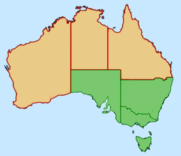
Time zones in Australia with daylight saving time
Lord Howe Island in the Tasman Sea uses UTC +10.30, but when it’s daylight saving time, it only moves the clocks forward by half an hour, using UTC +11.
It’s the only place in the world that does that.
Nepal, apart from its very special flag, have its own time zone: UTC +5.45.
In Spain, during the civil war, time was also part of the ideological difference: the Republican and Francoist zones had different times.
From 16 March 1940, Spain changed its time zone, choosing UTC +1.
During the Second World War, the Franco dictatorship synchronised its time with its ally Nazi Germany.
The same had to be done by the nations occupied by Hitler, the United Kingdom (which, however, reverted to Greenwich Mean Time after Soviet troops of the Red Army conquered Berlin) and France (which, like Spain, still maintains the same time zone as Germany).

Soviet Red Army soldiers hoist the CCCP flag over the Reichstag in Berlin
Argentina aadopted the international time zone system in 1920.
As I said before, each country can choose its own time zone, and, since the choice is often political, Argentine time has also changed according to the historical moment.
For the most part, the whole country would usually fall within the UTC -4 time zone.
Since 1974, Argentina has used daylight saving time, switching from UTC -3 in winter (which also corresponds to the easternmost part of Brazil) to UTC -2 in summer (which is the time zone in the middle of the Atlantic, quite far from Buenos Aires and Patagonia).
Since 2009, the country has been using UTC -3 as the official time throughout its territory, all year round.
In the newly formed Kingdom of Italy, from 12 December 1866 the ‘mean time of Rome’ was adopted for railways, post and telegraphs, with the exception of Sardinia (which retained the mean time of Cagliari, valid in the Kingdom of Sardinia) and Sicily (mean time of Palermo).
In Sardinia, Rome time was adopted only from 1886, except in a village near Alghero. This village chose to synchronise with Rome from 1872, because they felt inferior to the capital Cagliari.
When we talk about time zones, we should also think about the countries that use daylight saving time.
The idea behind daylight saving time is to save energy, but it’s mostly used in Europe and North America.
It seems like the decision to adopt it has almost always coincided with energy or oil crises.
But for countries close to the equator, the need for this change is less, as the amount of light and darkness they experience remains pretty consistent throughout the year.
Even countries in the far north don’t really benefit that much from it, so it’s probably a good thing that the push to keep the same hours always comes from them…
To put it simply, if I’ve explained it well, all you need to travel through time is to book a flight between two countries on opposite sides of the date change line.
The time difference, even for short distances, will allow you to go back in time or into the future.
Time is always a traveller’s enemy, but it can also be an entertaining dream-maker.
Here are some possibilities:
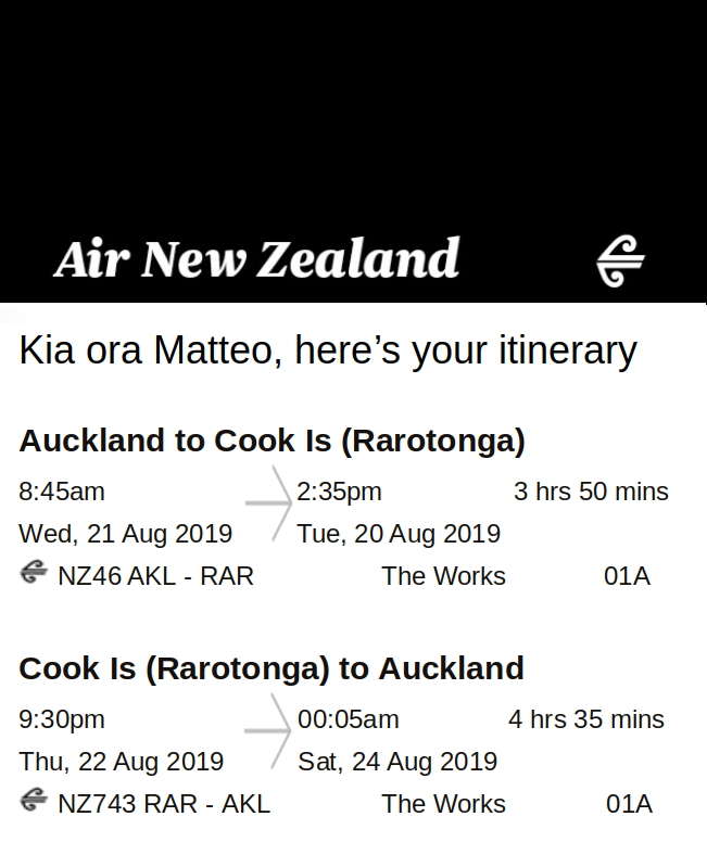
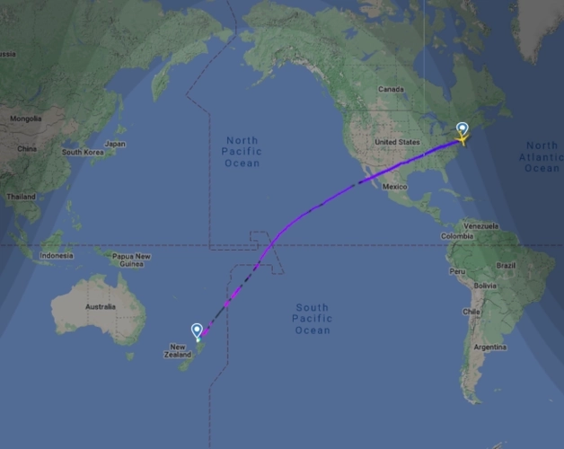
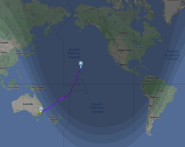
Flight Auckland (New Zealand, UTC +12) – Rarotonga (Cook Islands, UTC -10):
This is the route I used to travel back to the future.
The flight takes about 4 hours, but the 22-hour difference between the two countries means you can go back one day when flying from Auckland to Rarotonga, and forward two days if you fly overnight from Rarotonga to Auckland.
The route is operated by Air New Zealand and Jetstar Airways.
Flight Auckland – Rarotonga round trip – 2019 Oceania Travel Flight Auckland (New Zealand, UTC +12) – Niue (UTC -11):
Again, the connections are operated by Air New Zealand.
There’s usually just one flight a week: on Saturdays from Auckland, on Fridays from Hanan International Airport in Niue.
The flight takes about three and a half hours, but if you only fly in the morning or early afternoon, you always end up with ‘only’ one day to spare.
Auckland – New York flight
You can get to French Polynesia by flying to Aéroport International Tahiti Faa’a:
Air New Zealand and Air Tahiti Nui have connections to Auckland in New Zealand,
Hawaiian Airlines goes to Honolulu,
Delta Airlines and Air Tahiti Nui fly to Los Angeles and United to San Francisco,
Air France and Air Tahiti Nui handle the ‘domestic’ connections to Paris (whit stop over in Los Angeles, Seattle or San Francisco),
Sydney – Honolulu flight
Air Tahiti and Air Rarotonga connect Polynesia and the Cook Islands,
and the only direct connection to Asia is provided by Air Tahiti Nui, which flies to Tokyo.
Tokyo – Tahiti flight
When I went in Oceania in 2019, I wanted to travel with an Around The World ticket, stopping through Honolulu, Hawaii.
My relationship with the US has always been a bit rocky, and this feeling is mutual, so it didn’t surprise me when they rejected my ESTA application. So, as you can imagine, I can’t go to Honolulu.
This prohibits me from going but know that the airlines currently flying to Hawaii are: Air Asia, Air Canada, Air China, Air New Zealand, Alaska Airlines, All Nippon Airways, American Airlines, Asiana Airlines, China Airlines, China Eastern Airlines, Delta Airlines, Fiji Airways, Hawaiian Airlines, Japan Airlines, Jetstar Airways, Jin Air, Korean Air, Philippine Airlines, Qantas, Southwest Airlines, Sun Country Airlines, United e WestJet.

Air Rarotonga
Finally, if you want to travel through time like in the ‘Back to the Future’ series, just book a flight that crosses the date change line.
Where do you like to go?

cosmorevas travel map 2025-09-21
